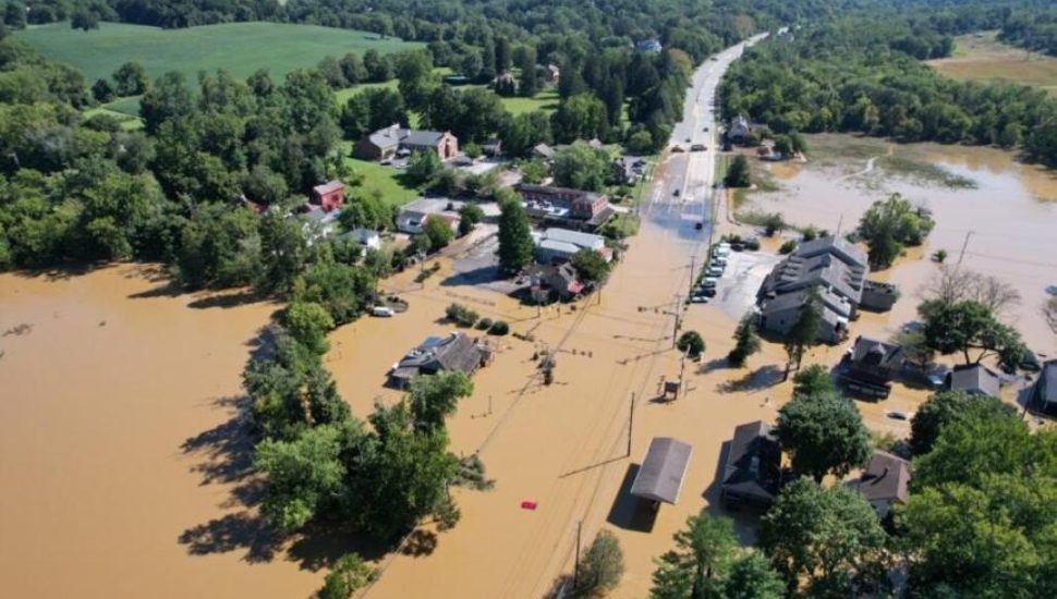
Later this year the Brandywine Flood Study will release a report to help communities understand why and when the Brandywine Creek floods and what can be done about it. Here’s a preview of the findings.
It wasn’t a hurricane when it hit Delaware on Sept. 1, 2021, but Tropical Storm Ida produced torrential rains with the heaviest rains falling on southeastern Pennsylvania. The day after the storm, residents of northeast Wilmington described the weather as “beautiful” and “sunny” when the floodwaters came.
It’s been a little more than two years since the city’s largest flood in 200 years, which led to the destruction of homes and businesses and caused long-term impacts on the lives of residents. Flooding is the most common weather hazard in Delaware, a coastal state with the lowest average elevation in the U.S., according to the Delaware Emergency Management Agency. Due to climate change, the frequency of flooding is expected to increase.
Gerald McAdams Kauffman, the director of the University of Delaware’s Water Resources Center, has been examining the lower Brandywine Creek and the flooding that devastated northeast Wilmington as a part of the study. He and his team have identified three main factors that contributed to the overwhelming volume of floodwaters that hit Wilmington’s 11th Street Bridge area in 2021. Findings that Kauffman said he hopes leaders consider as they plan future development — and insights residents could factor in when asked for their input.
Ida rain water is only part of the reason Northeast flooded
“I hate to say a perfect storm, but that’s exactly what happened,” said Kauffman, who also teaches at University of Delaware.
The Brandywine Creek is part of a large watershed or land that channels — or sheds — water into streams, creeks, lakes and oceans. It originates 30 miles north in Honey Brook, Pennsylvania. Geographically, Honey Brook is in the foothills of the Appalachian Mountains.
The once-in-200-year flood event began with ground already saturated from prior rains and waterways filled with water. According to Kauffman, Tropical Storm Ida’s water cascaded down from an elevation of a thousand feet, gathering more water as it flowed, including the eight to 10 inches of rain that fell near West Chester. It took the flood waters 12 hours to run through the funnel-shaped watershed from its wider end in Pennsylvania and into its narrow end in Wilmington’s northeast area. At the same time, the tide came in.
Find the full story here.
